Gabriel Wilkins
Graduate student at the University of Wisconsin, Madison for Urban and Regional Planning
BAs in Geography and Environmental Studies, Philosophy
3+ years of experience with GIS applications (including QGIS, R, ENVI, ArcMap, and ArcGIS Online).
View My LinkedIn Profile
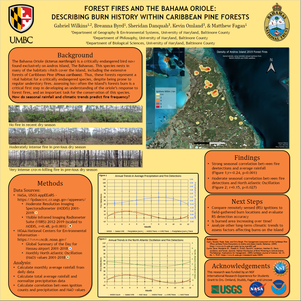
Forest Fires on Andros, The Bahamas
Presented at UMBC’s Summer Undergraduate Research Fest (August 7th, 2019)
Worked with the Omland lab and UMBC’s biology department to present data and analysis on forest fires on Andros, The Bahamas.
Compared the relative structures of forest understories in relation to how recent or intense they most recently burned.
Used remote sensing data to derive a kernel density of forest fire locations up to May 2019.
Plotted the trend of fire frequency across various months of the year and compared this to annual trends in North Atlantic Oscillation and
local precipitation.
Made with QGIS and Microsoft Excel using with data from NASA FIRMS, NOAA daily weather reports, and NOAA North Atlantic Oscillation values.